There’s a lot to uncover when it comes to weather fronts, as they play a significant role in determining the conditions you may encounter during your flights.
Understanding the differences between warm, cold, stationary, and occluded fronts will equip you with the knowledge to anticipate weather changes and make informed decisions.
Each type of front brings unique weather patterns, which can range from poor visibility to severe storms.
In this comprehensive guide, you will explore the characteristics and impacts of each front, enhancing your flying experience and ensuring greater safety.
What Are Weather Fronts?
Your understanding of weather is vital for effective flight planning, especially when it comes to weather fronts.
Defined as boundaries between two air masses, fronts dictate the changes in weather conditions you may encounter during a flight.
Staying informed about these transitions can make a significant difference in your safety and efficiency as a pilot.
Definition and Significance
To grasp the concept of weather fronts, consider them as the dividing lines where different air masses meet.
Each type of front brings unique weather patterns that can affect visibility, precipitation, and overall flying conditions.
You’re likely to encounter these fronts during your flights, impacting your navigation and decision-making processes.
Types of Air Masses
Below are the main types of air masses that can create various weather fronts, influencing your flying experience.
| Type of Air Mass | Description |
| Maritime Polar (mP) | Cool, moist air from the ocean. |
| Continental Polar (cP) | Cold, dry air from land. |
| Maritime Tropical (mT) | Warm, moist air from the ocean. |
| Continental Tropical (cT) | Hot, dry air from land. |
| Arctic (A) | Extremely cold air from the polar regions. |
This variety in air masses leads to a spectrum of weather phenomena, from light rain to severe storms, making it vital for you to understand their characteristics.
Masses of air carry unique properties that significantly influence atmospheric conditions.
Different air masses can blend, causing weather fronts to form and lead to various weather outcomes.
Pay attention to the type of air mass involved in the formation of a front, as it dictates how conditions will vary.
| Type of Air Mass | Characteristics |
| Maritime Polar (mP) | Cool with moisture; often leads to fog and drizzle. |
| Continental Polar (cP) | Cold and dry, often bringing clear skies. |
| Maritime Tropical (mT) | Warm and humid, likely to bring thunderstorms. |
| Continental Tropical (cT) | Hot, leading to dry conditions. |
| Arctic (A) | Extremely cold, potentially leading to severe weather in combination with other fronts. |
This understanding of air masses will better equip you to anticipate weather changes during flights, ultimately enhancing your safety and workflow.
Warm Fronts
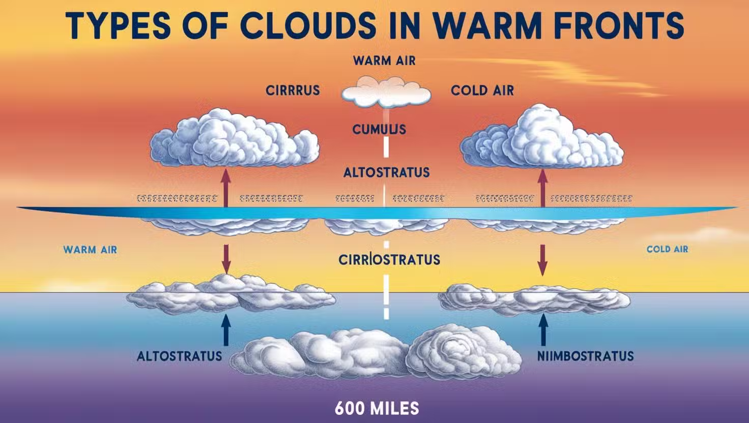
Any warm front occurs when a warm air mass advances and replaces a colder body of air.
Typically moving at a slower pace of 10-25 miles per hour, warm fronts set the stage for significant weather changes that you should be aware of, especially as a pilot.
Understanding how warm fronts influence visibility and atmospheric conditions can help you better anticipate the weather during your flight planning.
Characteristics
After a warm front advances, you can expect a gradual rise in temperatures, along with the presence of stratiform and cirriform clouds.
Although you will initially experience poor visibility, conditions will begin to improve once the warm front fully passes.
Be attentive to any light to moderate precipitation accompanying this type of front, as it can affect your flight route.
Associated Weather Patterns
Around warm fronts, low ceilings and reduced visibility are common, making them critical for flight safety.
The lifting action of the warm air can lead to the formation of clouds and light precipitation, which creates hazardous flying conditions if not accounted for.
In summer months, this can trigger more intense storms, such as cumulonimbus clouds, that could pose risks such as turbulence.
It is necessary to pay attention to the weather changes associated with warm fronts because they can impact your flight significantly.
The light to moderate precipitation generally means poor visibility, which can complicate your approach or landing.
After the warm front passes, visibility typically improves, but be wary of lingering hazy conditions.
Staying informed about these weather patterns ensures you can make well-informed decisions during your flight, ultimately enhancing your overall safety and efficiency.

Cold Fronts
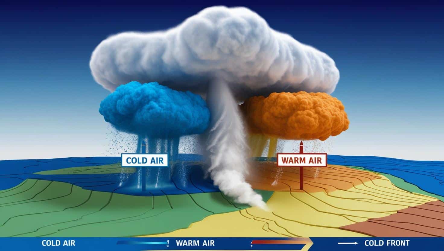
Some of the most dynamic weather changes occur with cold fronts, which happen when a colder air mass advances and displaces a warmer one.
Cold fronts typically move quickly, at speeds ranging from 25 to 30 miles per hour, and can even exceed 60 miles per hour in extreme cases.
This rapid movement can lead to significant shifts in atmospheric conditions, forcing the warm air upward and setting the stage for dramatic weather phenomena.
Characteristics
Behind the formation of cold fronts lies a fascinating interplay of air masses. As the colder air moves in, it forces the warmer air aloft, resulting in the development of towering cumulus or cumulonimbus clouds.
These clouds can lead to severe weather conditions, including thunderstorms, lightning, hail, and even tornadoes, depending on the instability of the warm air mass.
Impact on Weather
Across areas affected by cold fronts, you can expect rapid changes in weather. Initially, conditions may seem calm, but as the front approaches, clouds begin to build and precipitation often occurs.
The aftermath is marked by clear skies and a noticeable drop in temperature.
But the impact of cold fronts is not just about clearing skies and temperature drops.
Severe thunderstorms can develop with little warning, presenting dangerous conditions for anyone caught in the path.
You may face intense lightning, hail, and even tornadoes, which can pose a significant threat to safety.
In the wake of a cold front, while the skies clear rapidly, you will also experience gusty winds that can add to the challenges of flying or outdoor activities.
Understanding these characteristics of cold fronts is necessary for making informed decisions during changing weather conditions.

Stationary Fronts
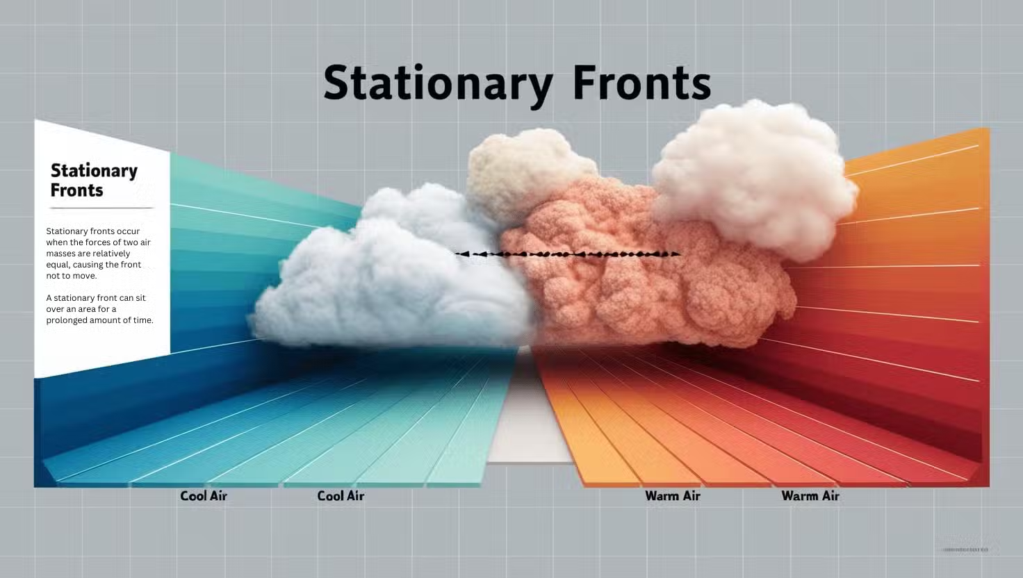
Many pilots find that stationary fronts present unique challenges as they can linger over an area for an extended period.
Characterized by the balance of forces between two air masses, stationary fronts often lead to prolonged weather conditions that can affect your flight planning and decision-making.
Definition and Duration
About stationary fronts, these occur when opposing air masses reach a state of equilibrium, halting any forward movement.
This lack of motion can result in persistent weather patterns that may last from a day to several days, impacting visibility and flight stability.
Weather Conditions
Behind stationary fronts, you can expect varied weather conditions that blend features of both warm and cold fronts.
They often bring light to moderate rainfall, overcast skies, and poor visibility due to stratiform clouds and fog. In some instances, this setup can generate thunderstorms, particularly if the warm air mass is unstable, affecting your flight strategy.
A stationary front holds the potential to create extended periods of challenging weather. You might encounter a mix of light rain, gray overcast conditions, and lower ceilings that can reduce visibility.
Additionally, if the air masses involved are relatively unstable, this can lead to the development of convective showers and thunderstorms, further complicating flight conditions.
Being aware of these dynamics can help you prepare for any extended periods of turbulence or adverse weather, enabling more informed decisions during your flight planning.

Occluded Fronts
Once again, occluded fronts signify a complex interaction between air masses, occurring when a faster-moving cold front overtakes a slower-moving warm front.
This creates distinct weather patterns as it pushes warm air aloft, leading to changes in both temperature and precipitation.
As an aviator, understanding occluded fronts is vital, as they can bring a mix of weather conditions, from precipitation to turbulent winds, affecting visibility and overall flight safety.
Types of Occlusions
On occluded fronts, you encounter two main types of occlusions:
| Type | Description |
| Cold Front Occlusion | This occurs when the cold front’s air mass is colder than the warm front’s air. |
| Warm Front Occlusion | In this case, the air in front of the warm front is colder than that of the advancing cold front. |
| Weather Patterns | Both types can create a mix of weather, including thunderstorms. |
| Wind Behavior | Expect significant changes in wind direction and intensity. |
| Duration | Occluded fronts can linger, affecting weather for an extended period. |
After understanding these two types of occlusions, you can better anticipate changes in weather conditions that may impact your flight operations.
Weather Implications
After an occluded front passes, you may experience variable weather conditions depending on the occlusion type.
Expect potential thunderstorms, fog, and precipitation, which can create challenging flying conditions.
At an occluded front, you should be aware that the transition from warm to cold air can lead to severe turbulence and even embedded thunderstorms, which pose significant risks. Visibility may decline rapidly, especially in the presence of precipitation and fog. Moreover, these fronts can linger, resulting in long-lasting adverse weather conditions.
By recognizing the signs of an occluded front, you can better prepare and make informed decisions during your flight operations.
Comparing Fronts: Warm vs. Cold
All fronts possess unique characteristics that influence weather patterns, and understanding these differences is necessary for anyone involved in aviation.
Below is a comparison of warm and cold fronts, highlighting key attributes that affect weather conditions.
Comparison Table of Warm and Cold Fronts
| Feature | Warm Front | Cold Front |
|---|---|---|
| Movement Speed | 10-25 mph | 25-30 mph |
| Weather Changes | Gradual, light to moderate precipitation, poor visibility | Rapid, intense weather changes, thunderstorms |
| Cloud Types | Stratiform, cirriform, possible cumulonimbus | Towering cumulus, cumulonimbus |
| Post-Front Conditions | Improving visibility and steady winds | Clear skies but gusty winds |
Key Differences in Weather
One of the primary distinctions between warm and cold fronts lies in the nature of the weather they bring.
Warm fronts typically produce light to moderate precipitation, often resulting in poor visibility and a gradual decrease in temperature. In contrast, cold fronts generate more intense weather events, including thunderstorms, wind gusts, and rapid temperature drops, presenting a greater challenge for pilots.
Understanding these conditions is pivotal for safe and effective flight planning.
Forecasting Challenges
Beside their inherent weather patterns, forecasting warm and cold fronts presents unique difficulties. Warm fronts advance more slowly, allowing for longer periods of inclement weather to develop, which can lead to unexpected changes in visibility and flight conditions. Cold fronts, on the other hand, can bring rapid and severe changes, leaving limited time for effective weather assessment and adjustments during your flights.
Fronts can develop rapidly, especially cold fronts, making forecasting a challenge. Understanding that cold fronts can approach with little warning is vital for your safety. Weather conditions can shift dramatically in a matter of hours, creating intense situations, including thunderstorms and possible turbulence. This unpredictability emphasizes the importance of staying updated and vigilant about weather patterns affecting your flights.
To Wrap Up
So, understanding the different types of weather fronts—cold, warm, stationary, and occluded—empowers you to anticipate changes in conditions that could affect your flight.
Each front presents unique weather patterns that can have a significant impact on visibility, temperature, and precipitation.
By familiarizing yourself with these concepts, you can make informed decisions during your flight planning process and enhance your overall flying experience.
